
Umiam Lake
"The Majestic Barapani"
Umiam Lake (commonly known to locals as Barapani or Dam Sait) is a massive man-made reservoir located in the Ri Bhoi district of Meghalaya, India, at 1,520 meters above sea level. Spanning over 220 square kilometers, this scenic body of water was created in 1965 by damming the Umiam River, serving as both a primary hydroelectric source and a premier water sports destination. Rated 4.5/5 on Google Maps with 5,000+ reviews, it remains the most iconic welcome gateway for travelers entering the Khasi Hills.
The Whispering Pines of Barapani
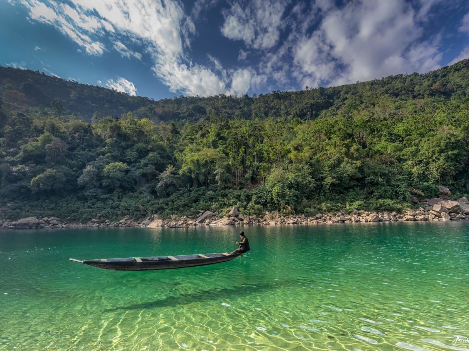
At dawn, a cold mountain mist rolls slowly across the vast indigo surface of Umiam Lake, carrying the sharp, resinous scent of the surrounding pine forests. As the morning sun climbs over the eastern ridges, the water transitions to a brilliant reflecting sheet of blue, mirroring the puffy cumulus clouds characteristic of Meghalaya's high plateau.
Early visitors can spot local Khasi fishermen quietly paddling small wooden dugout canoes along the quiet coves, casting hand-woven nets into the misty shallows. The shoreline is framed by dense groves of Pinus kesiya (locally known as the Khasi Pine), which thrive in this temperate, high-altitude climate.
The Tears of Heaven and the 1965 Dam
To appreciate Umiam, one must understand both its cultural mythology and its engineering history. In the local Khasi language, Umiam translates literally to the "Water of Tears." According to ancient folklore, two celestial sisters decided to descend from heaven to the earth. During their descent, one sister was lost in the dense forests of the Khasi Hills. Overwhelmed by grief, the surviving sister sat in the valley and wept inconsolably; her tears flowed in such abundance that they filled the deep gorges to create the lake.
In reality, the lake is an engineering marvel born of necessity. It was built between 1958 and 1965 by the Assam State Electricity Board as the first reservoir-storage hydroelectric project in Northeast India. The earth-fill dam stabilizes a massive catchment basin fed by the Umiam River and smaller streams in the Umsning block. The power generation and basin hydrology are managed by the North Eastern Electric Power Corporation, providing critical electricity across Meghalaya and Assam.
Catchments, Pines, and Indigenous Fishing
The ecological landscape surrounding the reservoir is a delicate balance of nature and community livelihood. The pine forests on the steep hills serve a crucial ecological purpose, stabilizing the soil and preventing erosion that would otherwise silt up the reservoir. The wetland margins are a sanctuary for avifauna, where birdwatchers can spot kingfishers, cormorants, and winter migratory ducks feeding in the shallows.
Within the waters, a rich aquatic ecosystem exists, home to native species like the Chocolate Mahseer (Neolissochilus hexagonolepis, locally called Kha Saw), Golden Mahseer (Tor putitora), and local varieties like Khabaw (Labeo pangusia) and Kha Ski (Labeo gonius). Local Khasi villages like Umsaw and Mawbsein practice traditional fishing under the close regulation of the Dorbar Shnong (village councils). To ensure the lakes aren't overfished, they implement Ka Jingkhrong, a voluntary community-led seasonal ban during breeding times. Caught fish are often smoke-dried using a traditional wooden frame structure called a Tympan to preserve them.
What NOT to Expect
Do not expect a secluded, untouched wilderness completely isolated from human activity. Umiam Lake is a working reservoir and a major highway transit point. Crowds are generally moderate to high, especially on weekends when the main viewpoints on National Highway 6 get congested with vehicles and street vendors.
There are no sandy beaches or public swimming zones. The reservoir has steep drop-offs with depths exceeding 30 meters near the dam, and swimming is strictly prohibited due to dangerous undercurrents. Furthermore, the public water sports complex is functional and simple rather than a luxury marina.
When Is the Best Time to Visit Umiam Lake?
- October to February (Peak Winter): The water is calm and clear, with morning mist creating scenic photography conditions. Temperatures hover between 10°C and 20°C, requiring light woolens in the evening.
- March to May (Spring/Summer): The weather is warmer, but the constant cool breeze off the water makes it very pleasant. Wildflowers bloom along the shores, making it perfect for kayaking and picnics in Nehru Park.
- June to September (Monsoon): The reservoir fills to maximum capacity and the surrounding hills turn an intense green. Boating is suspended during heavy downpours, but the dramatic cloud formations are spectacular for photography.
- September to October (Autumn Transition): A beautiful window with clean air, clear blue skies, and lower crowd levels.
A Photographer's Guide to Umiam
- The NH6 Viewpoint: Located directly on the highway as you drive from Guwahati to Shillong. It offers a classic, elevated panoramic shot of the entire lake and its pine-crested islands. Best photographed at sunrise or golden hour.
- The Ri Kynjai Peninsula: The banks near the Ri Kynjai resort offer a low-angle perspective of the water, with pine branches beautifully framing the shot.
- The Water Sports Complex Jetty: Capture close-ups of the colorful boats reflecting off the still water against the background of the misty hills.
- Important Security Restriction: Photography is strictly prohibited on the bridge and near the dam gates due to security regulations, though it is fully permitted in other tourist areas around the lake.
Getting There: Navigating the Gateway
Umiam Lake is located directly along National Highway 6 (NH6), acting as the gateway to the state capital and is accessible 24 hours a day. It is approximately 15 km north of Shillong (30 to 45 minutes by road) and 85 km south of Guwahati (2 to 2.5 hours by road). All regional transit between the Guwahati airport/railway station and Shillong passes by Umiam. Most Nezo journeys, such as our 7-Day Meghalaya Explorer, halt here for a scenic break before ascending to Shillong.
Insider Tips
- Book a sunset boat ride: The final boat rides around 4:30 PM offer golden-hour reflections against the pine-lined banks.
- Explore Nehru Park: Walk along the quieter pine-shaded paths in the adjacent park to escape the highway crowds.
- Try local fried fish: Small stalls near the main viewpoint sell fresh fish caught by local fishermen.
- Carry light woolens in winter: Even if the day is sunny, the wind coming off the lake in December can be surprisingly cold.
- Bring binoculars: The marshy areas on the northern inlet are excellent for spotting cormorants and migratory ducks in January.
7-Day Meghalaya Tour Package: Shillong, Cherrapunji, Dawki & Mawphlang
Highlands, Living Root Bridges & Clear Waters
Visitor & Booking Protocol
Permit & Entry Check
No special state permit required for Indian citizens. Keep government photo ID ready at entrance.
Tickets & Cash Protocol
Entry desk is managed on-site. Carry small cash denominations (₹20, ₹50, ₹100) for entry and parking.
Certified Guide Desk
Authorized village community guides can be hired at the entry registration desk. Certified guide rates range between ₹800–₹1,500 depending on circuit and trail duration.
Timing & Departure Cutoff
Arrive during early morning hours (08:00–10:30 AM). Mountain trails, caves, and viewpoints generally stop inbound entry by 15:30 to ensure safe return before mountain dark.
Safety & Rules
- • Wear a life jacket: A life jacket is mandatory for all speedboating and kayaking activities.
- • No swimming allowed: Dangerous depths and strong currents near the dam make entering the water extremely hazardous.
- • Stay within designated areas: Avoid wandering close to the edge of the dam or the intake gates, which are restricted and dangerous zones.
- • Photography restriction: Photography is strictly prohibited on the bridge and near the dam gates due to security regulations, though it is fully permitted in other tourist areas around the lake.
- • Dispose of trash responsibly: Umiam Lake faces pollution challenges; carry all plastic bottles and wrappers back with you.
Frequently Asked Questions
More Places to Visit in Shillong
Handpicked stops our drivers pass every week.

Shillong City
The scenic Scotland of the East.
1496m ASL
-
Shillong Peak
The towering crown of Meghalaya, offering panoramic highland vistas.
1965m ASL

Laitlum Grand Canyon
Sheer grassy precipices plunging 900 meters into the misty gorges of the East Khasi Hills.
1800m ASL

Mawphlang Sacred Forest
An ancient, deity-protected grove preserved for over eight centuries.
1800m ASL
-
Bamboo Trek in Mawryngkhang
Climb the legendary King of Stones along a handcrafted Khasi bamboo cliff path suspended over the Umrew River gorge.
900m ASL

Don Bosco Museum
A world-class anthropological journey through the tribal heritage of Northeast India.
1496m ASL
Best Time to Visit
Best time of day: Afternoon
Visitor Specs
Accessible 24 hours, but water sports activities typically operate from 09:00 to 17:00
How to Reach
Altitude & Terrain
4,990 ft
7-Day Meghalaya Tour Package: Shillong, Cherrapunji, Dawki & Mawphlang
Highlands, Living Root Bridges & Clear Waters
Location
Lng: 91.897000
Plan Your Trip to Shillong with Nezo
Combine Umiam Lake with living tribal heritage, scenic mountain vistas, and handpicked local stays on a private guided journey.